Ouvert Aujourd'hui | 10 h - 18 h
Confetti
RÉPERTOIRE
BOUTIQUES
PLAN DU CENTRE
Promotions
PROMOTIONS – BOUTIQUES
PROMOTIONS – RESTAURATION
Événements-Concours
Événements
Concours
Info-Centre
HORAIRES
Carte-cadeau
Services
UNEPLANÈTE
L’ÉCOUTE
Infolettre
Nous contacter
Nous contacter
Les emplois
location
FR
|
EN
FR
|
EN
Confetti
RÉPERTOIRE
BOUTIQUES
PLAN DU CENTRE
Promotions
PROMOTIONS – BOUTIQUES
PROMOTIONS – RESTAURATION
Événements-Concours
Événements
Concours
Info-Centre
HORAIRES
Carte-cadeau
Services
UNEPLANÈTE
L’ÉCOUTE
Infolettre
Nous contacter
Nous contacter
Les emplois
location
401 Boul Labelle Rosemère QC J7A 3T2
Rester connecté
En Soldes
Femme
Homme
Bébé & enfant
Beauté
Maison
Pâques
Les Essentiels Du Bal
Essentiels du Printemps
Boutiques
Marques
Liste de souhaits
Liste de souhaits
Rechercher
Rechercher
Articles en promotions pour femmes
Vêtements
Hauts
Bas
Manteaux
Maillots de Bain
Pyjamas
Sous-vêtements
Robes & combinaisons
Accessoires
Chaussettes
Bonneterie
Chapeaux
Bandeaux
Écharpes
Gants et Mitaines
Lunettes de soleil
Lunettes
Ceintures
Portefeuilles
Montres
Bijoux
Chaussures
Baskets
Bottes
Sandales
Tongs
Escarpins
Ballerines
Entretien des chaussures
Sacs & sacs à dos
Cartable
Sac messager
Sac saddle
Fourre-touts
Sacs de voyage
Sac hobo
Pochettes
Sports et fitness
Yoga
Vêtements de sport
Sports de plein air
Gym
Articles en promotions pour hommes
Vêtements
Hauts
Bas
Manteaux
Maillots de Bain
Pyjamas
Sous-vêtements
Accessoires
Chaussettes
Chapeaux
Bandeaux
Écharpes
Gants et Mitaines
Lunettes de soleil
Lunettes
Ceintures
Cravates & nœuds papillons
Portefeuilles
Montres
Chaussures
Baskets
Bottes
Sandales
Tongs
Derbies
Entretien des chaussures
Sacs & sacs à dos
Sac messager
Sacs de voyage
Porte-documents
Bagages
Articles en promotions pour bébé & enfant
Vêtements
Hauts
Bas
Manteaux
Pyjamas
Sous-vêtements
Équipements
Poussettes
Porte-bébés
Repas
Sièges auto
Lits bébé
Jouets
Jeux vidéo
Consoles
Manettes
Jeux de construction
Puzzles
Poupées
Coffrets de jeu
Peluches
Déguisements
Articles en promotions pour beauté
Soins de la peau
Gommages visage
Peelings visage
Nettoyants visage
Huiles essentielles
Sels de bain
Gel douche
Démaquillant
Crèmes hydratantes
Sérums visage
Rasages
Lotion tonique
Solaires
Soins après-soleil
Maquillages
Visage
Yeux
Lèvres
Accessoires
Cheveux
Shampoings
Après-shampoings
Traitements des cheveux
Coloration cheveux
Brosse à cheveux
Élastique à cheveux
Serviette pour cheveux
Fer à boucler
Lisseur
Sèche-cheveux
Ongles
Vernis à ongles
Lime à ongles
Articles en promotions pour maison
Chambre
Draps de lit
Oreillers
Matelas
Protège-matelas
Cuisine
Batterie de cuisine
Ustensiles de cuisine
Appareils de cuisine
Bureau
Papeterie
Articles en papier
Décorations
Bougies
Tapis
Vases
Rideaux
Décorations murales
Meubles
Chaises
Canapés
Bancs
Bureaux
Étagères
Miroirs
Électronique
Ordinateurs portables
Écrans
Souris
Écouteurs
Haut-parleurs
Home cinéma
Câbles
Piles & batteries
Étuis
Caméras
Chaussures
Accessoires
Robes Pour Femmes
Chemises Pour Hommes
Vêtements
Chaussures
Accessoires
Maison
Activités de plein air printanières
ALDO
AMNESIA MODE
Bath & Body Works
Bell
Bentley
Best Buy
Bikini Village
Boathouse
body & beach
BOHO boutique bébé
BOPIED TENDANCES
Browns
Cazza Petite
Change Lingerie
Claire France Tailles 14+
Clement
Colori
Dans Un Jardin
De Carrini Trends
de neuville
Dormez-vous
Doucet Latendresse
Dynamite
Ema & Carla
Ernest
FACES COSMETIQUES
Fido
Foot Locker
GameStop
Garage
Globo
Greiche & Scaff
Grif & Graf
H&M
HOCKEY EXPERTS
INDUSTRIA
Jack & Jones
Jean Bleu
JEUXJUBES
Kozy
LA BAIE D'HUDSON
La Forfaiterie
La Vie en Rose
Laura
Laura Secord
Lavigueur
Le Chapelier
Le Château
LESFLYKIDZ
LIBRAIRIE CARCAJOU
Lids
Lilianne Lingerie
Lush
MAEXOU
MANTEAUX MANTEAUX
Marie Claire
Maska
Melanie Lyne
Mia
Mobile Klinik
New Look
Pandora
pentagone
Reitmans
ROGER ROY
RW & Co.
San Francisco
Skechers
Soft Moc
Stokes
Stylo.ca
Sunrise Records
Suzy Shier
T Shirt Time
TOP MODE
Tristan
Urban Behavior
Urban Kids
Vincent D'Amerique
Walmart
WAVE SANS FIL
WLKN
X2B CHAUSSURES
Yves Rocher
ZARA
Apple
Birkenstock
Burberry
Columbia
Geox
Gucci
Hunter
Kate Spade
Marc Jacobs
Michael Kors
Nike
Nintendo
Oakley
Ray-ban
Samsung
Timberland
Toms
UGG
Under Armour
Vans
Versace
Wishbone
Bouton Fermer
Liste de souhaits
Rechercher
toutes catégories
Bouton Fermer
En Soldes
Femme
Homme
Bébé & enfant
Beauté
Maison
Pâques
Les Essentiels Du Bal
Essentiels du Printemps
Boutiques
Marques
Accueil
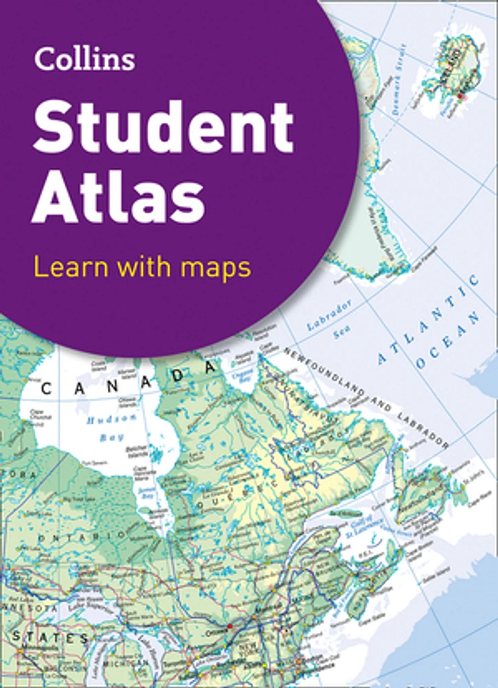
Collins Student Atlas (Collins School Atlases)
Collins Student Atlas (Collins School Atlases)
Malheureusement, cet article n'est plus disponible, mais nous avons trouvé des articles similaires qui pourraient vous plaire.
Information produit
Vous pourriez aussi aimer
Liste de souhaits
Ajouter à votre liste de souhaits
Aperçu rapide
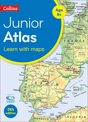
Collins Junior Atlas (Collins School Atlases)
Librairie Carcajou
Liste de souhaits
Ajouter à votre liste de souhaits
Aperçu rapide
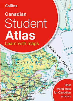
Collins Canadian Student Atlas
Librairie Carcajou
Liste de souhaits
Ajouter à votre liste de souhaits
Aperçu rapide
Collins World Atlas: Essential Edition
Librairie Carcajou
Liste de souhaits
Ajouter à votre liste de souhaits
Aperçu rapide
Collins World Atlas: Essential Edition
Librairie Carcajou
Liste de souhaits
Ajouter à votre liste de souhaits
Aperçu rapide
Collins World Atlas: Paperback Edition
Librairie Carcajou
Liste de souhaits
Ajouter à votre liste de souhaits
Aperçu rapide
Collins World Atlas: Reference Edition
Librairie Carcajou
Liste de souhaits
Ajouter à votre liste de souhaits
Aperçu rapide
Collins Children’s Picture Atlas
Librairie Carcajou
Liste de souhaits
Ajouter à votre liste de souhaits
Aperçu rapide
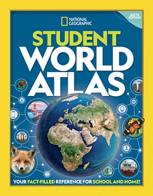
National Geographic Student World Atlas
Librairie Carcajou
Liste de souhaits
Ajouter à votre liste de souhaits
Aperçu rapide
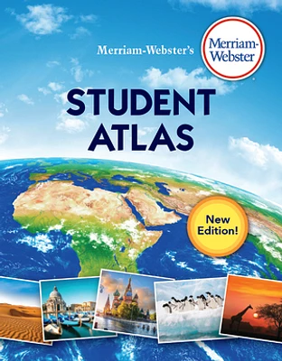
Merriam-Webster's Student Atlas
Librairie Carcajou
Liste de souhaits
Ajouter à votre liste de souhaits
Aperçu rapide
Merriam-Webster’s Student Atlas
Librairie Carcajou
Liste de souhaits
Ajouter à votre liste de souhaits
Aperçu rapide
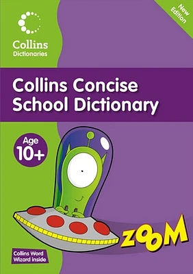
Collins Primary Dictionaries - Collins Concise School Dictionary
Librairie Carcajou
Liste de souhaits
Ajouter à votre liste de souhaits
Aperçu rapide
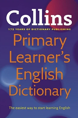
Collins Primary Learner's Dictionary
Librairie Carcajou
Continuez à magasiner
Durabilité
En soldes
Nouveautés
Homme
Femme
Enfant
Beauté
Bijoux
En savoir plus sur LIBRAIRIE CARCAJOU chez Place Rosemère
Livres de tous genres pour jeunes et adultes. Service de commandes et recherches. Réservations et informations en ligne.
401 Boul. Labelle, Rosemère, QC J7A 3T2, Canada
Informations sur le magasin
450 437-0690
Itinéraire
Voir la carte
Plus de détails