


Home
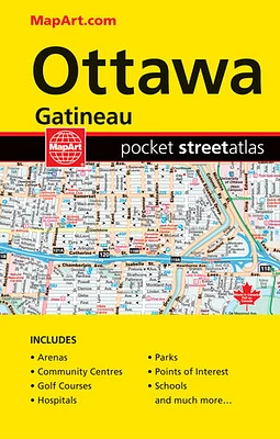
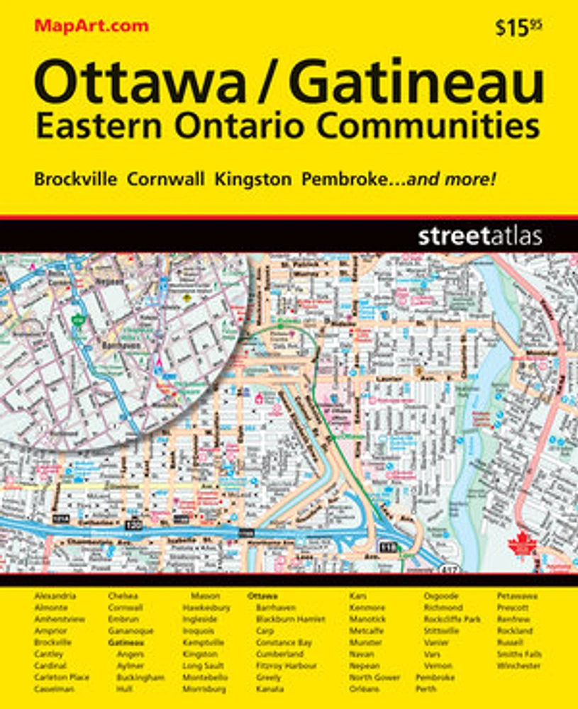
Ottawa Gatineau Eastern Ontario Communities Street Atlas
LIBRAIRIE CARCAJOU
Ottawa Gatineau Eastern Ontario Communities Street Atlas
From Librairie Carcajou
Current price: $15.95
Loading Inventory...
*Product information may vary - to confirm product availability, pricing, shipping and return information please contact LIBRAIRIE CARCAJOU
It’s the definitive auto companion for travel in this area, whether you are a resident or short-term visitor. It’s got all the features to make even the unfamiliar areas easy to navigate.
Inside this 256 page atlas you will find city maps (1:20,000/1:62,000), back road maps (1:250,000), locator maps, feature listings (points of interest, hospitals, golf clubs, universities and colleges, shopping centres), downtown Ottawa map, street maps index and regional maps road and community index.
City mapping includes Alexandria, Almonte, Amherstview, Arnprior, Brockville, Cantley, Cardinal, Carleton Place, Casselman, Chelsea, Cornwall, Embrun, Gananoque, Gatineau (Angers, Aylmer, Buckingham, Hull, Masson), Hawkesbury, Ingleside, Iroquois, Kemptville, Kingston, Long Sault, Montebello, Morrisburg, Ottawa (Barrhaven, Blackburn Hamlet, Carp, Constance Bay, Cumberland, Fitzroy Harbour, Greely, Kanata, Kars, Kenmore, Manotick, Metcalfe, Munster, Navan, Nepean, North Gower, Orléans, Osgoode, Richmond, Rockcliffe Park, Stittsville, Vanier, Vars, Vernon), Pembroke, Perth, Petawawa, Prescott, Renfrew, Rockland, Russell, Smiths Falls and Winchester
The detailed city maps features include divided highways, major roads, secondary roads, main thoroughfares, minor streets, lanes / private streets, interchange numbers, one way streets, street address numbers, railways, VIA Rail stations, O-Train stations, transitway stations; rapibus, bus only streets, bus stations, carpool parking, municipal boundaries, recreation trails, park conservation areas, golf courses, commercial areas, cemeteries, institutional areas, industrial areas, special attraction areas, national defence, hospitals, tourist information centres, police stations, fire halls, municipal / regional buildings, courthouses, libraries, points of interest, off leash dog parks, beer stores, liquor stores, National parks / historic sites, community / recreation centres, pools, baseball, soccer, tennis, skiing, campgrounds, public and catholic schools.
The back road maps features include expressways to seasonal roads, airports, train stations, ferries, locks, lock numbers, OPP, Québec Police, hospitals, customs, tourist information centres, rapids, waterfalls, beaches, peaks, rest areas, skiing, golf, wharfs, boat launches, marinas, points of interest, sugar shacks, campgrounds, UNESCO World Heritage sites, National Historic sites, bird watching, viewpoints/looksouts, lighthouses, National and Provincial parks, conservation areas, bird sanctuaries, populations and more.
Wire-O bound
Proudly made in Canada!
21.5 x 27 cm (8.47 x 10.75 inches)
Provinces/Territories: Ontario, Quebec